Southwest parks in 12 days: making time for wonder
From Las Vegas to Zion, Bryce, Antelope Canyon, Monument Valley and Grand Canyon: a loop shaped around the light, the walks and nights in the right places.
- Days
- 12
- Bases
- Las Vegas, Springdale, Bryce Canyon City, Page, Monument Valley, Grand Canyon Village or Tusayan
- Getting around
- Hire car for the loop; park shuttles where operating; guided visits where required
- Best time to go
- May and the second half of September, with possible cold at higher elevations and trail conditions to check
- Budget
- Spending examples: around USD 3,000–4,000 each, sharing as a pair; flights and insurance excluded
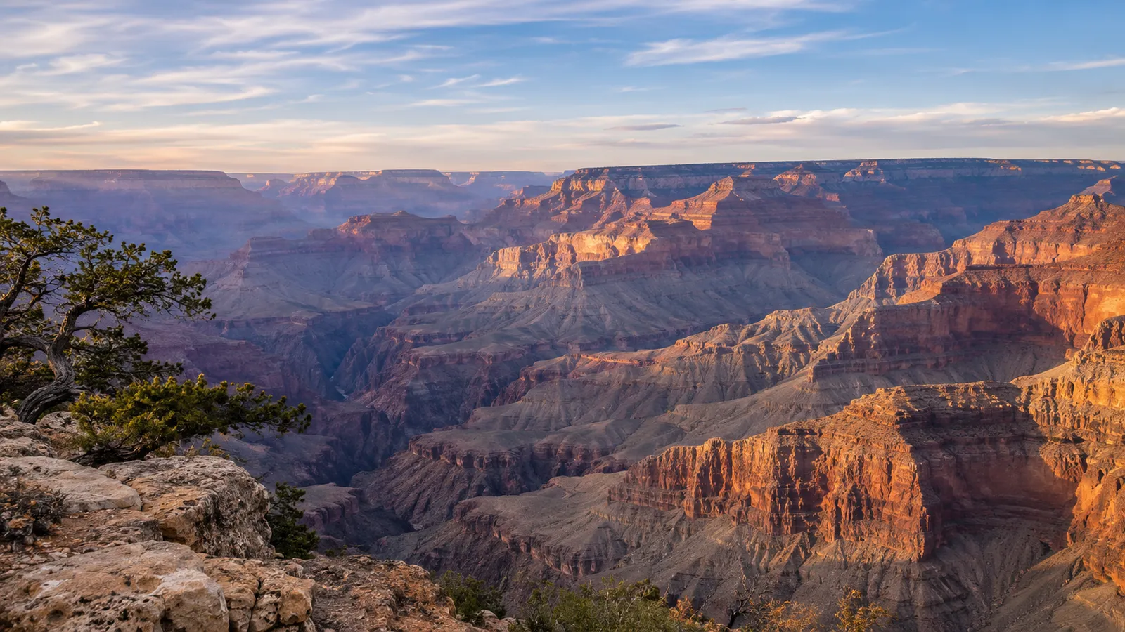
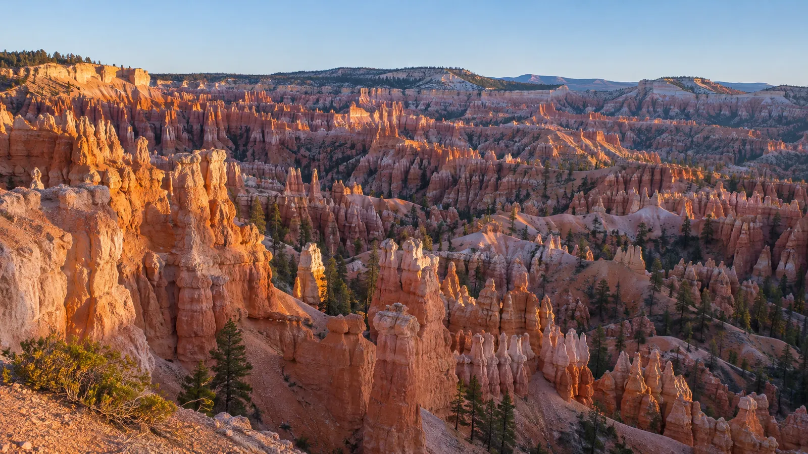
At Bryce, light slips between the spires, separating one column from the next; at Zion, it meets walls so high that the valley floor stays in shadow. At Grand Canyon, the eye keeps finding another layer in the distance. Images like these can easily spark a desire to travel through the Southwest. Planning the journey calls for a more concrete choice: where to stay long enough to watch the landscape change.
We suggest a twelve-day loop from Las Vegas through Utah and Arizona, with eleven nights in the United States. Zion, Bryce, Page, Monument Valley and the South Rim form the thread of the route. This is a road trip with walks and opportunities for hikes, designed for anyone who wants to alternate sweeping views with time in each place. More demanding outings remain individual choices: permits, preparation and conditions may change the programme without taking away its purpose.
A route that changes scale
These landscapes share a geological connection. The National Park Service describes the Grand Staircase as a succession of rock layers and escarpments between Bryce and Grand Canyon, revealed by uplift and erosion. Along the route, the exposed rocks change, as do our vantage points and the work of water. At Zion we stand inside the valley; at Bryce we look into an amphitheatre of slender forms; at Grand Canyon we face a depth that makes us reconsider distance.
Las Vegas allows a circuit with the car collected and returned in the same city. An initial night separates arrival from the first drive; the final two allow time for the return and a day nearby. Between these ends, we spend eight nights among the landscapes that drew us here. Flight schedules may require an additional night: the twelve days refer to the American programme, not a guaranteed total duration from leaving home to returning.
Seven stops, eleven nights
1. Las Vegas1 night
Arrive, rest and collect the car without immediately adding a long drive.
2. Springdale · Zion2 nights
Have a full day in the canyon and choose walks according to actual conditions.
3. Bryce Canyon City1 night
Stay near the amphitheatre for the evening and the first morning light.
4. Page2 nights
Give Antelope Canyon and Horseshoe Bend time, with room between appointments.
5. Monument Valley1 night
Explore the valley with a Navajo guide and stay in the area as the light changes.
6. Grand Canyon · South Rim2 nights
Combine viewpoints with a day along the rim or a carefully chosen hike.
7. Return to Las Vegas2 nights
Break up the return and keep a day for the city or an outing nearby.
Why twelve days
The two-night stays at Zion, Page and Grand Canyon are central to this proposal: they avoid moving on every morning and allow an activity without squeezing it between two long drives. Bryce and Monument Valley get one night each, but retain an evening and a morning in the area. With ten days, we first reduce the final stay in Las Vegas; with fourteen, we add a night at Zion and another at Bryce for more freedom to walk. Adding another major park changes the geography of the circuit. The day-by-day programme is in the Explore itinerary: here, the reasons behind the stops matter most.
Zion: choose the walk before the photograph
In Zion Canyon, greenery along the Virgin River contrasts with sandstone walls, rock formed from grains of sand cemented together over time. Springdale, the town near the entrance, lets you visit the park without changing accommodation. When the system is operating, the town shuttle takes you towards the pedestrian entrance and the park shuttle travels through the canyon: check how the two services work before choosing your final walk.
The walls also tell of a vanished landscape. Navajo Sandstone comes from ancient dunes: the slanting lines through the rock preserve the arrangement of windblown sand. Later, uplift gave watercourses the power to cut into the layers. The Virgin River continues this work today. Pausing near the valley floor lets you follow both the geometry of the cliffs and the small river helping to reshape them.
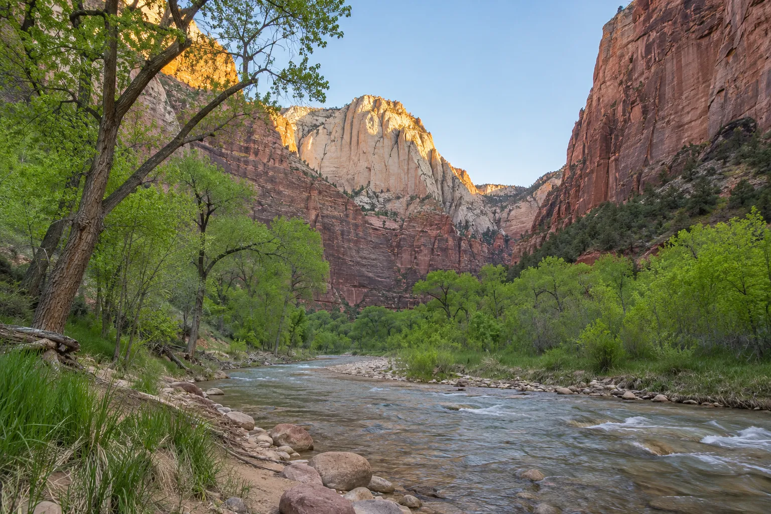
For a first encounter with Zion, the Riverside Walk follows the river through trees as the walls gradually draw closer. It starts at Temple of Sinawava, the final shuttle stop, and is about 3.2 km return: the park suggests one to two hours. It is a relatively easy paved walk, with slopes and uneven sections. You can look up at the walls while staying out of the water; at the end, retrace your steps or separately consider a hike into the Narrows.
Scout Lookout, by contrast, is a viewpoint high above the valley floor, reached from The Grotto along the West Rim Trail. The climb tackles steep switchbacks and sections near drop-offs, rewarded by views of Zion's walls and the Angels Landing ridge. Allow for about 6 km return and three to four hours according to the park: fitness is needed, and heat adds to the effort. You do not need the Angels Landing permit to stop here, but it is not an easy alternative to the valley floor.
Angels Landing is the rocky spur reached by continuing from Scout Lookout along a narrow ridge, with chain-assisted passages and sheer drops. Views open along Zion Canyon from the summit, but the final section requires confidence on exposed terrain and is unsuitable for anyone uncomfortable with heights. For the full hike, the National Park Service gives about 8.7 km, 450 metres of ascent and four hours or more. The section beyond Scout Lookout requires a permit awarded by lottery: receiving one is not guaranteed. If you do not get one or the ridge is not for you, choose Scout Lookout only if the climb is within your abilities; otherwise, spend the day on the Riverside Walk and valley floor.
The Narrows are the section where the canyon tightens and the river becomes the route: you walk in the water between high, closely spaced walls, over slippery stones. Even a short outing needs suitable preparation and equipment; flow, cold water and flash-flood risk may make it impassable. In May, snowmelt can cause closures. We do not automatically combine it with Angels Landing on the same day: anyone wanting to stay dry can stop at the Riverside Walk.
Bryce: a night to watch the spires emerge
At Bryce, the shapes seem to multiply as soon as sunlight reaches the sides of the columns. They are called hoodoos: tall, irregular rock spires, sometimes resembling towers or pinnacles topped by a broader cap. Their concentration fills the great natural amphitheatre with pink, orange and cream. Water and frost gradually separate the rock along fractures, as the park's explanation of their formation describes: knowing how they form helps you recognise walls, ridges and isolated columns.
To see them without descending into the canyon, start with the rim section between Sunset Point and Sunrise Point: about 1.6 km return, level and paved, with the expanse of spires below you. It is a straightforward way to take in the amphitheatre's layout. Descending among the hoodoos takes you to their feet and conveys their height, but adds elevation change and a climb back up: choose the route and check openings according to your energy. This rim path at Bryce is separate from Grand Canyon's Rim Trail.
Sleeping in Bryce Canyon City allows you to catch the first light without setting out from a distant town. Assess any descent among the spires against trail openings and your energy; viewpoints on the rim already offer different perspectives. The altitude is most noticeable in the morning and evening: Bryce's climate overview highlights cold and possible snow in spring and autumn, broadly March–May and September–November. Pack warm layers even if the trip begins in the warm light of Las Vegas.
Page and Monument Valley: visiting on each place's terms
Page is the base for two different landscapes. At Horseshoe Bend, the Colorado makes a great horseshoe-shaped curve around a rocky spur, seen from above. Upper Antelope Canyon is a narrow sandstone gorge: its water-carved, undulating walls admit light through the opening overhead. Here, a visit with an authorised guide is compulsory, not an optional service added to independent entry. Book the tour and follow the operator's meeting-point details and instructions. The exit route described by Ekis' includes sand, stairs and ramps: being on a tour does not remove obstacles. Sunbeams depend on season, time and conditions; the curves of the walls remain the reason to visit even without that particular light.
Upper is not the only choice. Lower Antelope Canyon offers another route between winding walls, with stairs and ladders to negotiate; the Antelope Canyon X tour visits two sections of gorge. These visits also require an authorised guide. Compare the route, obstacles and duration above all: you can choose one of the three experiences for your Page stay without doing them all.
For an independent hike, separately consider Wire Pass towards Buckskin Gulch: two narrow passages between rock walls lead to the junction with a larger canyon. A guide is not compulsory, but a day-use permit is required. It is about 5.5 km return to the junction, with access along an unpaved road: trail conditions, weather and flash-flood risk need their own preparation. This is a hiking day to organise, not an equivalent visit to an Antelope tour.
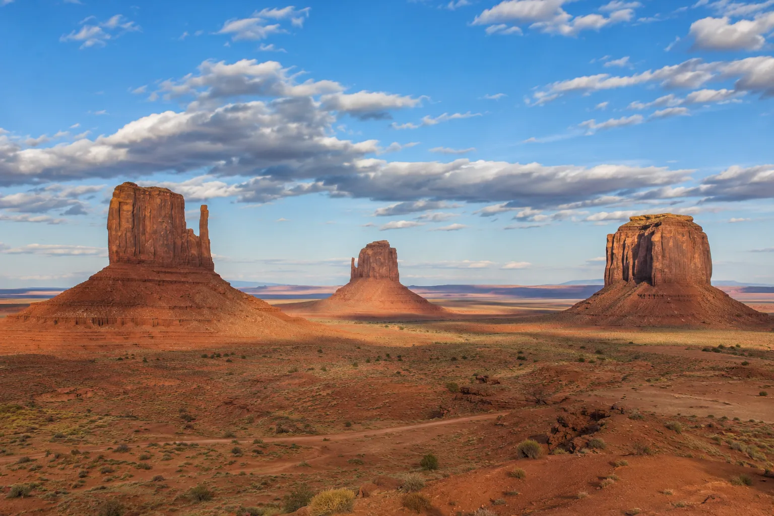
Monument Valley is a tribal park of the Navajo Nation. Its great isolated rock masses belong to a territory inhabited, managed and described by the Diné, the Navajo people. A guide authorised by the Navajo Nation lets you discover the valley through a local voice and, depending on the tour, reach areas not accessible independently. Permitted routes, photography and stops follow local rules; a national parks ticket does not replace tribal entry.
Grand Canyon: two nights to let distance change
The South Rim, Grand Canyon's southern edge, concludes the journey through the great landscapes. Arriving from Monument Valley, the Desert View area offers an initial outlook; approaching Grand Canyon Village changes the orientation and depth of the views. Two nights let you return to the rim at different times and choose between a scenic walk and a more demanding descent into the canyon.
The Rim Trail follows the southern edge for about 21 km, but also works well in short sections. Its appeal is the changing view as you walk: cliffs and gorges overlap differently without a descent into the canyon. To start, we suggest Mather Point–Yavapai Point and the geology museum: about 1.1 km one way, paved, with short slopes and almost continuous views. Allow half an hour plus stops; walk back or check the shuttle connection when operating. Other sections to the west are unpaved and more demanding. Even on the rim, bring water, protect yourself from the sun and stay on the path: not every overlook has railings.
The horizontal bands record different environments: shallow seas, coastal plains and dunes left sediments that later became rock. The Colorado and erosion cut into this archive, exposing its pages; the age of the rocks and that of the canyon are therefore two different stories. The park's geological interpretation helps you recognise this sequence. From a viewpoint, pick a pale band and follow it with your eyes: you will find continuity between walls that distance seemed to separate.
Walking below the rim means climbing back up: the ease of the first downhill steps can be misleading. The National Park Service advises against reaching the river and returning in a day. You do not need to do so to understand the canyon's scale. A day on the rim, with a stop at the geology museum and time before the same view, can be a fulfilling choice. Before setting out, check closures, weather and water availability for your actual route.
These depths also have a human history. The park recognises the connections of eleven tribal communities associated with Grand Canyon. Their relationships with the territory continue today. Paying attention to Indigenous voices and interpretation at visitor sites gives meaning to a view we often know only through its image.
Where to sleep: the value of already being close
In Springdale, choose accommodation considering distance from the entrance and shuttle stops, as well as parking. In Bryce Canyon City, being able to set out easily in the morning matters; in Page, access to your booked tour's meeting point. For Monument Valley, compare accommodation around the park and at Goulding's, reading the actual room's location and conditions. At Grand Canyon, consider Grand Canyon Village or Tusayan: the former reduces some journeys, while the latter is an outside base. Park accommodation and links are listed on the official lodging page. When checked on 11 November 2026, operator Xanterra reported its South Rim lodges closed until 19 November following damage to water infrastructure, with reopening planned for the 20th: this is a forecast to recheck, not a guarantee. You need actual confirmation of accommodation for your travel dates. In Las Vegas, compare the total including taxes, resort fees and parking before deciding a room is good value.
Extensions we leave for another trip
To keep the loop to twelve days, we suggest these exclusions: they reflect this itinerary's structure and can be reconsidered if priorities change.
They shift the journey towards California and require redesigning the route rather than adding a simple detour.Yosemite and San Francisco
They form a separate circuit much farther north, deserving days of their own.Yellowstone and Grand Teton
The detour towards Moab deserves extra nights; here we preserve the two-night stays at the chosen bases.Arches and Canyonlands
The budget: separating prices from spending choices
To give a sense of scale, we compare two spending examples of around USD 3,000–4,000 per person for twelve days and eleven nights, with two adults sharing a room and car. These are simulations using chosen planning allowances, not a range of observed prices or a prediction of your costs. Intercontinental flights and travel insurance are excluded. The first allows USD 200 per room per night and USD 900 per person for meals throughout the trip; the second raises these to USD 250 and USD 1,200, with a higher car-hire allowance too. The table shows how the individual shares change: quotes for your dates may fall outside these examples.
Official prices checked in November 2026 help establish some items. The annual pass for non-US residents costs USD 250 and covers occupants of a private vehicle under NPS rules, including nonresident surcharges at the parks concerned. In our two-person model, we therefore allocate USD 125 each. Guided visits, tribal entry, state parks and other costs outside its coverage must be calculated separately.
As a reference for Upper Antelope Canyon, Ekis' Antelope Canyon Tours lists an adult base fare of USD 95 plus a USD 15 park fee, with booking fees added; time and season can change the price. For a 2027 departure, recheck prices: verification in November 2026 does not lock in a future trip's cost.
Two examples compared: amounts per person
Rounded example totals; flights and insurance excluded≈ 3,000–4,000 USD
Food spending depends on included breakfasts, supermarket shopping, picnics and restaurants. Tax, tips and drinks can substantially change the bill: a daily allowance is no promise of what you will spend. The Red Rock Grill menus at Zion provide a concrete reference to compare with your habits.
Helicopter trips, lake cruises and shows are extras excluded from the examples. Before booking, replace each allowance with the actual full quote: rooms including tax and supplements, a car with insurance cover and contractual charges, and tours with fees. The reserve cannot accommodate every comfort choice; even USD 4,000 is not a guaranteed ceiling.
Choosing a season for the whole loop
May and the second half of September are the windows we suggest for combining the different elevations, each with its limitations. In May, river flow may close the Narrows and Bryce mornings remain cold; in September, heat may still matter in lower areas and canyon conditions need attention. In summer, June–August, adapt walks to heat and thunderstorms; in winter, December–February, snow and short days change the programme's structure. Recheck Grand Canyon conditions and those of the other parks close to departure.
Book the accommodation that defines the loop and limited-capacity tours first, then build your days around the confirmations. Keep a few hours free for a longer stop, an open trail or light that invites you to linger. Between Zion, Bryce and Grand Canyon, the rock continually changes form: allowing time to notice is the choice that holds the journey together.
The day by day, ready to use: it’s in Explore.
12 days and 63 places on the map, with times and travel. Open it, import it into your trips and change it as you like.
7 stages · 11 nights
Liked an article? Make it your trip
Plan the days, the places and the budget with Daysaway, on the map, with the help of the assistant.