Itinerary · 17 days · October–November
Australia's wild south in 17 days: Sydney, Tasmania, the Great Ocean Road and Kangaroo Island
 DaysawayBy Daysaway@daysaway
Rate this trip
Sign in to rate it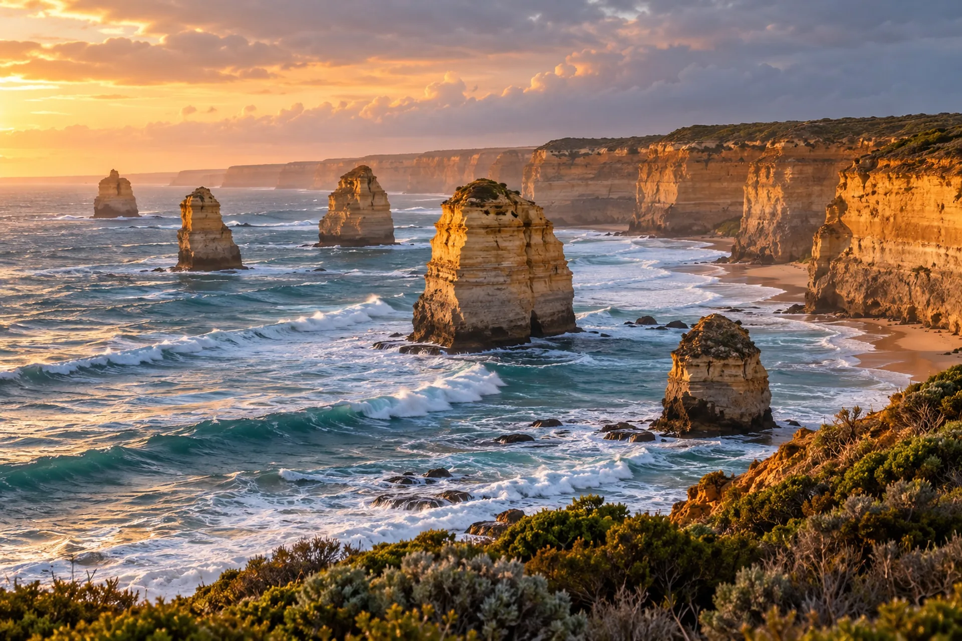
- Days
- 17 days
- in October–November
- Rhythm
- ≈ 7 stops a day
- 114 stops in all
- Style
- Cities
- from its places
Don’t miss
the stops the author marked Must
Day by day
Index of days
17 days, one per row. Pick a day to read it in full.
Day 1 · Thu 28 Oct
Harbour, The Rocks and BridgeClimb
7 stops · 8.8 km on foot · from 11:30 to 20:00
Arrival in Sydney
11:30
Transport· Transport- Nice to have
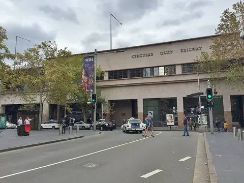
The harbour's ferry hub: buskers, ferries coming and going and the first view of the Opera House and the bridge.
9 min on foot
12:10
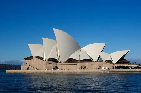
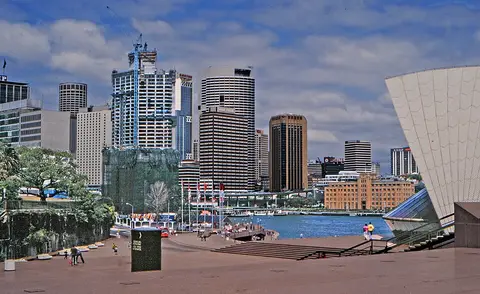
MustSight· AttractionWalk round the white sails and up the steps: the classic view of the harbour from Bennelong Point.
15 min on foot
13:15
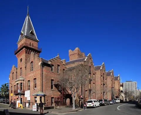
Food· AreaThe Rocks is a suburb, tourist precinct, and historic area of Sydney's city centre. It is on the southern shore of Sydney Harbour, and immediately north-west of the Sydney CBD.
9 min on foot
14:25
Sight· Nature- Nice to have
A quiet park above The Rocks with one of the best free views of the Harbour Bridge.
3 min by car
16:00
Activity· Attraction- Highlight
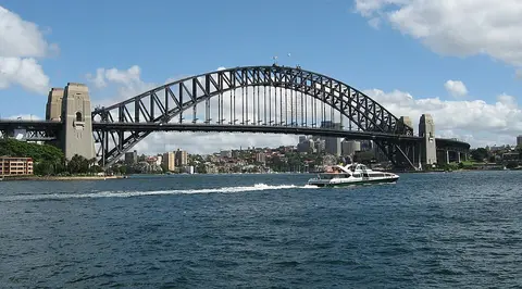
Climb the arches of the bridge to the summit, 134 m above the harbour: book a twilight climb for the sunset over the city.
16 min on foot
20:00
Food· AreaThe Rocks is a suburb, tourist precinct, and historic area of Sydney's city centre. It is on the southern shore of Sydney Harbour, and immediately north-west of the Sydney CBD.
17 min on foot
Night
Stay· City3 nights, around Circular Quay, The Rocks or Darling Harbour: close to the ferries.
Day 2 · Fri 29 Oct
Spit to Manly and Watsons Bay
7 stops · 23.7 km by car · from 08:30 to 18:45
08:30
Sight· Attraction- Highlight
10 km of bush, coves and Aboriginal rock engravings along Middle Harbour, ending on Manly's beaches. Bus to the Spit Bridge.

6 min by car
12:45
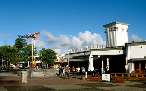
Food· CityManly is a beach-side suburb of northern Sydney, in the state of New South Wales, Australia. It is 17 kilometres (11 mi) north-east of the Sydney central business district and is currently one of the…
4 min by car
13:55
Sight· Nature- Nice to have
A sheltered cove where you can snorkel with friendly blue gropers just off the sand.

15:00
Ferry from Manly to Circular Quay
15:45
Ferry from Circular Quay to Watsons Bay
16:30
Sight· Nature- Highlight
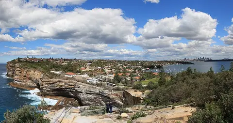
Sheer sandstone cliffs dropping into the Pacific at the mouth of the harbour.

5 min by car
17:30
Sight· Attraction- Nice to have
The red-and-white striped lighthouse at the tip of South Head, past Camp Cove and Lady Bay.

13 min on foot
18:45
Food· AreaWatsons Bay is a harbourside, eastern suburb of Sydney, in the state of New South Wales, Australia. Watsons Bay is located 11 km north-east of the Sydney central business district, in the local…
17 min by car
Night
Stay· CitySydney is the capital of the state of New South Wales and the largest city in Australia. The metropolis surrounds Sydney Harbour and extends about 80 kilometres (50 mi) from the Pacific Ocean in the…
Day 3 · Sat 30 Oct
Royal National Park coast
6 stops · 101 km by car · from 07:30 to 19:00
07:30
Pick up the rental car for the day
09:25
Sight· Attraction- Highlight
A coastal walk in Australia's oldest national park to a white sandstone ledge over the ocean: admire it from behind the fence.

1 h 17 min by car
13:15
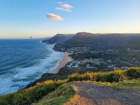
Food· AreaStanwell Park is a coastal village and northern suburb of Wollongong, New South Wales, Australia. It is the northernmost point of the Illawarra coastal strip and lies south of Sydney's Royal National…
3 min by car
14:20
Sight· Nature- Highlight
Hang-gliders take off over the beach from this headland, with the coast and the Sea Cliff Bridge below.
6 min by car
15:00
Sight· Attraction- Highlight
A road bridge curving out over the ocean below the cliffs: walk its footpath.

17:00
Return the rental car
46 min by car
19:00
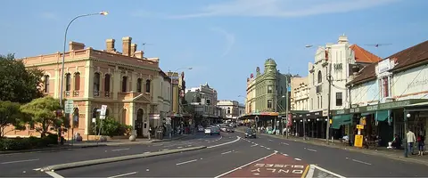
Food· AreaNewtown, a suburb of Sydney's inner west, is located approximately four kilometres south-west of the Sydney central business district, straddling the local government areas of the City of Sydney and…
7 min by car
Night
Stay· CitySydney is the capital of the state of New South Wales and the largest city in Australia. The metropolis surrounds Sydney Harbour and extends about 80 kilometres (50 mi) from the Pacific Ocean in the…
Day 4 · Sun 31 Oct
Hobart's convict past
7 stops · 21.6 km by car · from 08:00 to 19:00
08:00
Flight from Sydney to Hobart
10:15
Pick up the rental car in Hobart
One-way rental: returned at Launceston Airport on 6 November.
11:15
Sight· Area- Nice to have
Hobart's old sailors' quarter: Georgian cottages around Arthur Circus and lanes down to the water.

12 min on foot
12:30
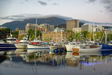
Food· CityHobart (Southeast Tasmanian: nipaluna) is the capital and most populous city of the island state of Tasmania, Australia. Located in Tasmania's south-east on the estuary of the River Derwent, it is…
10 min on foot
13:40
Sight· Attraction- Highlight
A row of 1830s sandstone warehouses on the harbour, now galleries, cafés and craft shops.

6 min by car
14:45
Sight· Attraction- Highlight
A UNESCO convict site where thousands of women prisoners were sent: their stories told in the old yards.

9 min by car
16:30
Sight· Nature- Nice to have
An old signal station on a hill above the Derwent, with views over Hobart and the river mouth.

9 min by car
19:00
Food· CityHobart (Southeast Tasmanian: nipaluna) is the capital and most populous city of the island state of Tasmania, Australia. Located in Tasmania's south-east on the estuary of the River Derwent, it is…
0 min on foot
Night
Stay· City3 nights, in Battery Point or near Salamanca: walking distance from the MONA ferry.
Day 5 · Mon 1 Nov
kunanyi sunrise and MONA
6 stops · 32.7 km by car · from 05:30 to 19:00
05:30
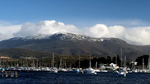
MustSight· NatureDrive up to the 1,271 m summit before dawn and watch the sun rise over Hobart and the Derwent. Bring warm layers.
09:30
Ferry to MONA
The MONA ferry from Brooke Street Pier: sit on the sheep seats on the deck.
10:00
MustSight· AttractionAustralia's most provocative museum, dug into the sandstone cliff of a peninsula: ancient and contemporary art about sex and death.

4 min by car
13:05
Food· AreaBerriedale BERR-ee-dayl is a residential suburb located in the northern part of Hobart, the capital city of Tasmania, Australia. Situated within the City of Glenorchy, it lies between the suburbs of…
14:15
Ferry back to Hobart
15:30
Sight· Attraction- Nice to have
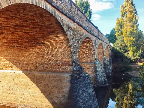
Australia's oldest bridge still in use, built by convicts in 1823, in a Georgian village of sandstone houses.
21 min by car
19:00
Food· AreaNorth Hobart is a suburb of the city of Hobart, Tasmania, Australia. It lies directly north of the Hobart central business district.

20 min on foot
Night
Stay· CityHobart (Southeast Tasmanian: nipaluna) is the capital and most populous city of the island state of Tasmania, Australia. Located in Tasmania's south-east on the estuary of the River Derwent, it is…
Day 6 · Tue 2 Nov
Bruny Island
7 stops · 97.3 km by car · from 08:30 to 19:00
08:30
Ferry from Kettering to Bruny Island
The car ferry across the D'Entrecasteaux Channel: about 40 minutes' drive from Hobart to Kettering.
09:20
Sight· Nature- Highlight
Climb the steps over the narrow isthmus joining North and South Bruny: ocean on one side, channel on the other.
1 h 11 min by car
11:15
Sight· Attraction- Highlight
An 1838 lighthouse on wild cliffs at the southern tip of the island, facing the Southern Ocean.

1 h 11 min by car
13:30
Food· AreaAdventure Bay is the name of a locality, a township and a geographical feature on the eastern side of Bruny Island, Tasmania. At the 2021 census, Adventure Bay had a population of 218.

18 min by car
14:50
Food· Café & barCheese made on the island and beer brewed next door, tasted on a bench in the garden.
11 min on foot
15:45
Food· Café & barOysters farmed in Great Bay, opened in front of you a few hundred metres from the water.
16:45
Ferry from Bruny Island to Kettering
19:00
Food· CityHobart (Southeast Tasmanian: nipaluna) is the capital and most populous city of the island state of Tasmania, Australia. Located in Tasmania's south-east on the estuary of the River Derwent, it is…
0 min on foot
Night
Stay· CityHobart (Southeast Tasmanian: nipaluna) is the capital and most populous city of the island state of Tasmania, Australia. Located in Tasmania's south-east on the estuary of the River Derwent, it is…
Day 7 · Wed 3 Nov
Freycinet and Wineglass Bay
7 stops · 110 km by car · from 09:30 to 19:00
09:30
Sight· Attraction- Nice to have
An 1840s convict bridge with its parapet of fieldstones set on edge, on the coast road north.
52 min by car
10:45
Sight· Nature- Highlight
Up through pink granite to the lookout over the perfect curve of the bay, then down to the white sand: about 11 km return. Bring a picnic.

17 min by car
15:10
Food· Restaurant24 min by car
16:40
Sight· Attraction- Highlight
A short boardwalk round the cliffs over the Tasman Sea, with the granite peaks of the Hazards behind.

13 min by car
17:45
Sight· Nature- Nice to have
A tiny cove of orange-lichened granite under the Hazards, beautiful in the late light.

7 min by car
19:00
Food· CityColes Bay is an Australian town on the east Coast of Tasmania 192 km north-east of Hobart and 173 km south-east of Launceston, being the main entrance point for visitors to the Freycinet National…
0 min on foot
Night
Stay· City1 night at the entrance of Freycinet National Park.
Day 8 · Thu 4 Nov
Bay of Fires and Cataract Gorge
6 stops · 288 km by car · from 08:30 to 19:00
08:30
Sight· Attraction- Nice to have
Waves forced through a crack in the granite shoot up in a roaring spout.

1 h 11 min by car
10:30
Sight· Nature- Highlight
White beaches and boulders covered in bright orange lichen, from Binalong Bay to The Gardens.

19 min by car
12:30
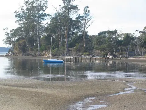
Food· CitySt Helens is the largest town on the north-east coast of Tasmania, Australia, on Georges Bay. It is known as the game fishing capital of Tasmania and is also renowned for its oysters (as are some…
1 h 47 min by car
16:00
Sight· Nature- Highlight
A river gorge a few minutes from the city centre: cliff walks, a suspension bridge, peacocks and the chairlift over the First Basin.

7 min by car
19:00
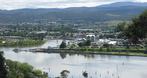
Food· CityLaunceston is a city in the north of Tasmania, Australia, at the confluence of the North Esk and South Esk rivers where they become the River Tamar (kanamaluka). As of 2021, the Launceston urban area…
0 min on foot
Night
Stay· City1 night.
Day 9 · Fri 5 Nov
Cradle Mountain and its wildlife
8 stops · 85.8 km by car · from 09:15 to 19:30
09:15
Sight· City- Nice to have
The 'town of murals': painted walls telling the story of the pioneers, on the way to Cradle Mountain.

49 min by car
11:00
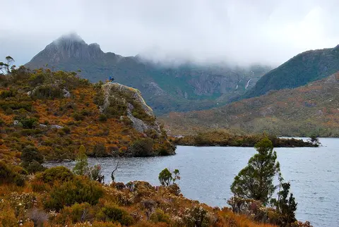
MustSight· NatureA 6 km walk round a glacial lake under the jagged peaks of Cradle Mountain, past the old boatshed.
12 min by car
14:15
Food· Area
20 min on foot
15:40
Activity· Nature- Nice to have
A short loop through mossy rainforest along a tumbling creek, with wombat burrows.
2 min by car
16:15
Sight· Attraction- Highlight
A conservation sanctuary for the Tasmanian devil and the quolls: go for the guided feeding tour.
5 min on foot
18:00
Food· Area10 min by car
19:30
Transport· Parking- Highlight
At dusk the wombats graze on the button-grass plain along the boardwalk: walk slowly, keep your distance.
10 min by car
Night
Stay· Area1 night just outside the national park, where the wildlife comes out at dusk.
Day 10 · Sat 6 Nov
Marions Lookout, then Melbourne
5 stops · 112 km by car · from 07:30 to 20:00
07:30
Sight· Nature- Highlight
A steep morning climb from Dove Lake to a ridge with the whole of Cradle Mountain and its lakes below.
1 h 15 min by car
11:15
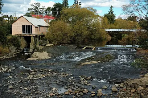
Food· CityDeloraine is a town on the Meander River, in the central north of Tasmania, Australia. It is 50 kilometres (31 mi) west of Launceston and 52 kilometres (32 mi) south of Devonport along the Bass…
13:00
Return the rental car at Launceston Airport
14:15
Flight from Launceston to Melbourne
18:30
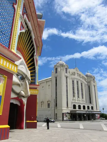
Food· AreaSt Kilda is an inner seaside suburb in Melbourne, Victoria, Australia, six kilometres (3+1⁄2 miles) southeast of the Melbourne central business district, located within the City of Port Phillip local…
10 min by car
20:00
Sight· Attraction- Highlight
At sunset a colony of little penguins comes home to the breakwater at the end of the pier: volunteers explain, no flash.

10 min by car
Night
Stay· City2 nights, in the CBD or Southbank.
Day 11 · Sun 7 Nov
Laneways, market and Fitzroy
9 stops · 15.4 km by car · from 09:30 to 19:00
09:30
Sight· Attraction- Highlight
Melbourne's most famous laneway, every wall covered in street art that changes week by week.

5 min on foot
10:10
Sight· Attraction- Nice to have
A narrow lane of café tables: the place for a proper Melbourne flat white.

6 min on foot
10:50
Sight· Attraction- Nice to have
The city's oldest arcade (1870), with its mosaic floor and the giant clock figures Gog and Magog.

16 min on foot
11:30
MustActivity· ShopA huge 19th-century market of produce, delis and stalls, open on Sunday: graze through the Deli Hall.

14 min on foot
12:55
Food· CityMelbourne is the capital and most populous city of the Australian state of Victoria and the second-most populous city in Australia. The city's name generally refers to a 9,993-square-kilometre (3,858…
6 min by car
14:00
Sight· Area- Highlight
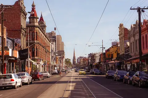
Melbourne's bohemian street: vintage shops, record stores, murals and old pubs; the Rose Street Artists' Market on weekends.
5 min by car
16:00
Sight· Nature- Nice to have
Elm avenues and Captain Cook's Cottage, shipped stone by stone from Yorkshire.

5 min by car
19:00
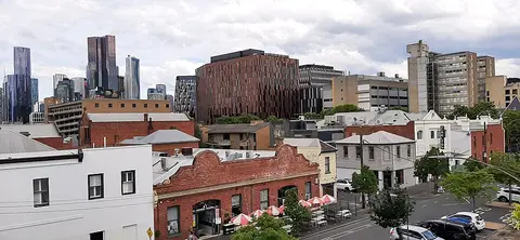
Food· AreaCarlton is an inner city suburb of Melbourne, Victoria, Australia, 3 kilometres north of the Melbourne central business district within the City of Melbourne local government area (LGA) and located…
4 min by car
Night
Stay· CityMelbourne is the capital and most populous city of the Australian state of Victoria and the second-most populous city in Australia. The city's name generally refers to a 9,993-square-kilometre (3,858…
Day 12 · Mon 8 Nov
Otways and the Twelve Apostles
8 stops · 192 km by car · from 07:30 to 19:45
07:30
Pick up the one-way rental car in Melbourne
One-way rental to Adelaide Airport, returned on 13 November: check the one-way fee and whether the car may go on the Kangaroo Island ferry.
10:00
Sight· Nature- Nice to have
A 30 m waterfall in a fern gully of the Otways behind Lorne, down a staircase through the rainforest.

11:15
Sight· Area- Highlight
Walk up Grey River Road and look up: wild koalas sleep in the eucalyptus right above the road.

12:30
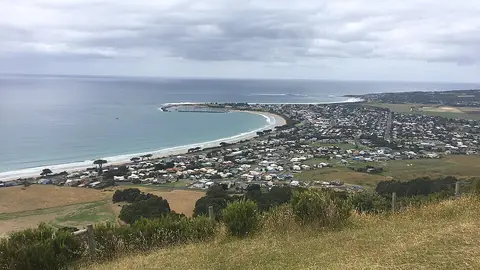
Food· CityApollo Bay is a coastal town in southwestern Victoria, Australia. It is situated on the eastern side of Cape Otway, along the edge of the Barham River and on the Great Ocean Road, in the Colac Otway…
30 min by car
14:00
Sight· Attraction- Highlight
Mainland Australia's oldest surviving lighthouse (1848), on cliffs where the Bass Strait meets the Southern Ocean.

1 h 2 min by car
16:20
Sight· Nature- Nice to have
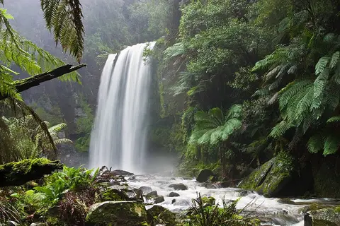
A waterfall in a deep green gully of tree ferns in the Otway rainforest, down a short steep path.
1 h 5 min by car
18:30
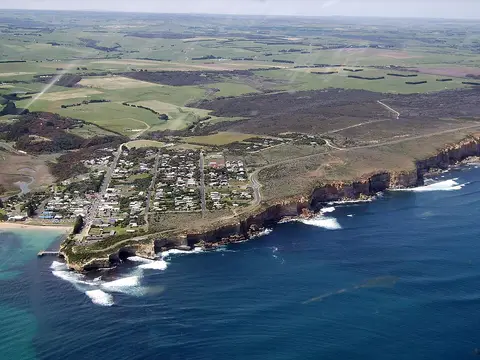
Food· CityPort Campbell is a town in Victoria, Australia. The town is on the Great Ocean Road, west of the Twelve Apostles, in the Shire of Corangamite. At the 2016 census, Port Campbell had a population of…
7 min by car
19:45
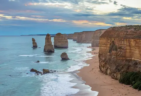
MustSight· AttractionLimestone stacks rising from the Southern Ocean, glowing gold at sunset: the icon of the Great Ocean Road.
7 min by car
Night
Stay· City1 night: the closest village to the Twelve Apostles.
Day 13 · Tue 9 Nov
Shipwreck Coast to the Grampians
9 stops · 295 km by car · from 08:00 to 18:30
08:00
MustSight· NatureA narrow cove between tall cliffs, named after the 1878 shipwreck whose two survivors washed up here.

12 min by car
09:15
Sight· Nature- Highlight
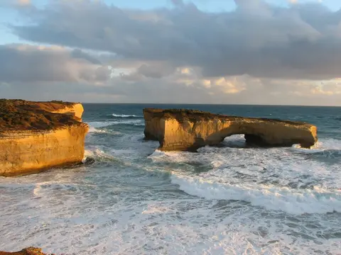
A rock arch that was a double bridge until its first span collapsed into the sea in 1990.
2 min by car
09:55
Sight· Nature- Nice to have
Steps down to a hollow in the cliff with a rock pool framing the ocean.

8 min by car
10:35
Sight· Nature- Nice to have
Quieter than the Apostles: a scatter of limestone stacks in a wide bay.

45 min by car
11:50
Sight· Nature- Highlight
A nature reserve inside an extinct volcano: emus, koalas and kangaroos wander free along the trails.

18 min by car
13:25
Food· CityPort Fairy (historically known as Belfast) is a town in south-western Victoria, Australia. It lies on the Princes Highway in the Shire of Moyne, 28 kilometres (17 mi) west of Warrnambool and 290…

1 h 57 min by car
17:00
Sight· Nature- Nice to have
A platform on the edge of the escarpment over Halls Gap and Lake Bellfield.

16 min by car
18:30
Food· AreaAt dusk kangaroos graze on the town's oval and around the lodges.

0 min on foot
Night
Stay· Area1 night in the heart of the Grampians.
Day 14 · Wed 10 Nov
Grampians, then Adelaide
5 stops · 498 km by car · from 07:30 to 19:00
07:30
Sight· Nature- Highlight
Up through the Grand Canyon and Silent Street to a rock ledge high above Halls Gap: the Grampians' classic walk.

59 min by car
11:05
Sight· Nature- Highlight
The Grampians' biggest waterfall, reached by a steep stairway down to the pool at its foot.
36 min by car
12:45
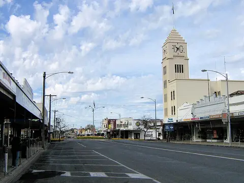
Food· CityHorsham is a regional city in the Wimmera region of western Victoria, Australia. Located on a bend in the Wimmera River, Horsham is approximately 300 kilometres (190 mi) northwest of the state…
4 h 17 min by car
19:00
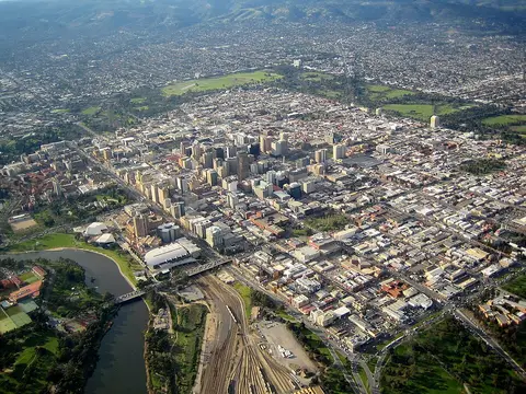
Food· CityAdelaide (Kaurna: Tarndanya) is the capital and most populous city of South Australia, as well as the fifth-most populous city in Australia. The name "Adelaide" may refer to either Greater Adelaide…
0 min on foot
Night
Stay· City1 night: leave early tomorrow for the Cape Jervis ferry, about 1 h 45 min south.
Day 15 · Thu 11 Nov
Kangaroo Island: sea lions
7 stops · 115 km by car · from 09:00 to 19:00
09:00
SeaLink ferry from Cape Jervis to Penneshaw
Book the car on the ferry well ahead; leave Adelaide by 07:00.
11:00
Sight· Nature- Highlight
Walk on the beach among a colony of Australian sea lions resting after days at sea.

18 min by car
12:40
Food· AreaVivonne Bay is a locality in the Australian state of South Australia located on the south coast of Kangaroo Island. It is located about 174 kilometres (108 miles) southwest of the state capital of…

1 min by car
13:45
Sight· Nature- Nice to have
A long curve of white sand and turquoise water, often called one of Australia's best beaches.
38 min by car
15:05
Sight· Nature- Highlight
Huge white dunes in the middle of the bush: rent a sandboard and slide down.

54 min by car
16:55
Sight· Attraction- Highlight
A walk under the gum trees full of wild koalas; kangaroos and wallabies come out as the light fades.
21 min by car
19:00
Food· AreaVivonne Bay is a locality in the Australian state of South Australia located on the south coast of Kangaroo Island. It is located about 174 kilometres (108 miles) southwest of the state capital of…
0 min on foot
Night
Stay· Area2 nights on the south coast, between Seal Bay and Flinders Chase. Drive slowly at dusk: wildlife on the roads.
Day 16 · Fri 12 Nov
Flinders Chase
7 stops · 116 km by car · from 09:30 to 18:45
09:30
Sight· Nature- Nice to have
A guided tour of limestone caves full of helictites, under the bush of the south coast.
30 min by car
11:15
Sight· Nature- Nice to have
The ruins of the lighthouse keepers' store and a cliff path where supplies were hauled up from the sea.
3 min by car
12:00
Sight· Attraction- Highlight
A natural arch hung with stalactites at the tip of the island, with long-nosed fur seals on the rocks below.
13:10
Picnic lunch in Flinders Chase
No restaurants in the park: buy supplies in Vivonne Bay the day before.
7 min by car
14:15
Sight· Attraction- Highlight
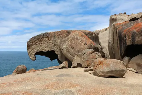
Huge granite boulders sculpted by wind and sea into strange shapes, stained orange by lichen, on a dome above the ocean.

46 min by car
16:20
MustSight· NatureThe bush recovering after the 2020 fires: short walks near Rocky River, where kangaroos and Cape Barren geese graze late in the day.
58 min by car
18:45
Food· AreaVivonne Bay is a locality in the Australian state of South Australia located on the south coast of Kangaroo Island. It is located about 174 kilometres (108 miles) southwest of the state capital of…
0 min on foot
Night
Stay· AreaVivonne Bay is a locality in the Australian state of South Australia located on the south coast of Kangaroo Island. It is located about 174 kilometres (108 miles) southwest of the state capital of…
Day 17 · Sat 13 Nov
Adelaide Hills and home
3 stops · 15.3 km by car · from 08:30 to 16:45
08:30
SeaLink ferry from Penneshaw to Cape Jervis
About 1 h 30 min from Vivonne Bay to Penneshaw: leave by 06:45.
11:00
Sight· Area- Nice to have
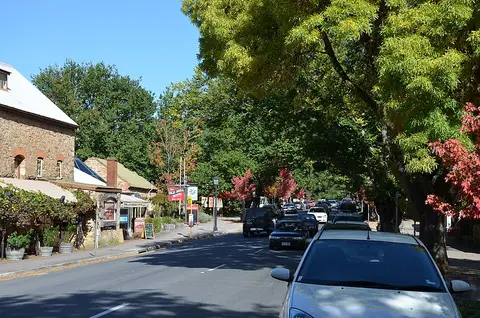
A village founded by Lutheran settlers from Prussia in 1839: German bakeries, galleries and old stone cottages.
0 min on foot
12:00
Food· AreaHahndorf is a small town in the Adelaide Hills region of South Australia. Currently an important tourism spot, it has previously been a centre for farming and services.
12 min by car
13:30
Sight· Nature- Nice to have
The highest point of the Adelaide Hills, with the whole city and the gulf spread out below.
15:00
Return the rental car at Adelaide Airport
16:45
Flight home
Like this route? Make it your trip
Import it, change the dates, add your own places.